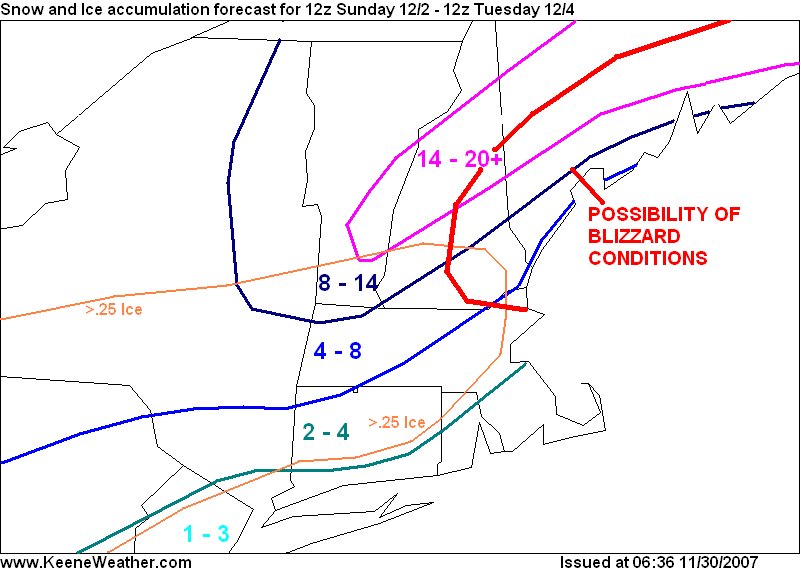
I have to make this quick, since Im heading off to school right now, but I'll update during my campus period. In summary, models have started to do more than "slightly" trend south and east. At this point, NWS AFD says axis of heavy snowfall lies over central NH. Just a few more miles south and we could be in for over a foot of snow. NWS zone forecast has added "heavy snow accumulations possible" Sunday Night and now have all snow for Monday. Im still hesitant to go gung ho with accumulations but did raise them up a little. For what its worth, 06z GFS and NAM both cream southern and central NH including potential blizzard conditions to our east. Still have two days for changes in either direction. So best bet is to remain conservative. Winter storm watches have been issued for a large portion of the midwest and into Pennsylvania. We will not be far behind.
Preliminary second snowfall forecast for 12z Sunday through 12z Tuesday: 6 to 12 inches.
Preliminary second ice accumulation forecast for 12z Sunday through 12z Tuesday: .1 to .25 inches.

No comments:
Post a Comment