New England so far is averaging between 2 and 4F above normal for temperatures. We have yet to see high heat this month, the likes of which hit the region in late April. However, days consistently in the 60's and low 70's are a couple degrees beyond the seasonal norms (albeit sensibly unnoticeable). This has been supported by ridging to our south. Other positive anomalies extending across the southern tier of the nation and negative anomalies across the Pacific northwest and Rockies.

The interior south and southeastern states have seen much above normal precipitation in the last two weeks with frequent severe weather episodes. One event that stands out was May 8th, when an intense mesolow and derecho developed along a front passing through Missouri, Illinois, Indiana and Kentucky.

The system developed an almost tropical appearance on radar, with a echo-free center and transverse banding on the north and northwest quadrants. Reports of winds between 80 and 110mph were received along the path of the derecho, with embedded tornadoes as well.
These events can be chalked up to pieces of energy pinwheeling around a persistent vortex over northern Quebec (could be described as a west based +NAO and a result of a strengthened Hadley from MJO wave related anomalies). In April, this led to intense eastern US ridging with associated record heat, but the vortex has strengthened to the point of suppressing heights further south.
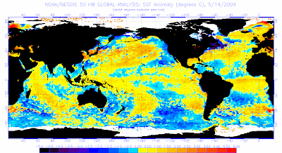
This MJO wave has since then lost its clear signal and has collapsed within the <1SD circle of phase space. Organizing convection off the coast of Africa suggests that the wave may reemerge around phase 3 sometime in the next couple weeks. The notable convective suppression that we've seen as a result of the previous wave has led to warming sea surfaces temperatures across Indonesia and through the western and central Pacific. At this point, we are in fact nearing weak El Nino status.

Despite this development, we are still experiencing some La Nina characteristics in the atmosphere. Specifically, we've seen a decent mountain torque event in east Asia contributing to negative AAM anomalies. While not distinctive on GWO phase space, overall we'll likely see cycles biased toward 1-4 through the end of May, and toward 2-6 during June, which continues to support my outlook for above normal temperatures in the eastern third and southwest corner of the CONUS with below normal temperatures over the northern and central plains.
No comments:
Post a Comment