I will post more on the January pattern later, as well as a look at February in a few days. For now, I want to focus on a specific day which currently insists on attention: Saturday, January 3, 2009.
Both the Euro and GFS have been indicating for numerous runs the potential for a Miller A/B hybrid affecting much of the east coast on the 3rd.
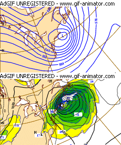
 The 12z 12/25 ECMWF showed a very strong Miller B sitting off the coast of New England at hour 216 (12z 1/3).
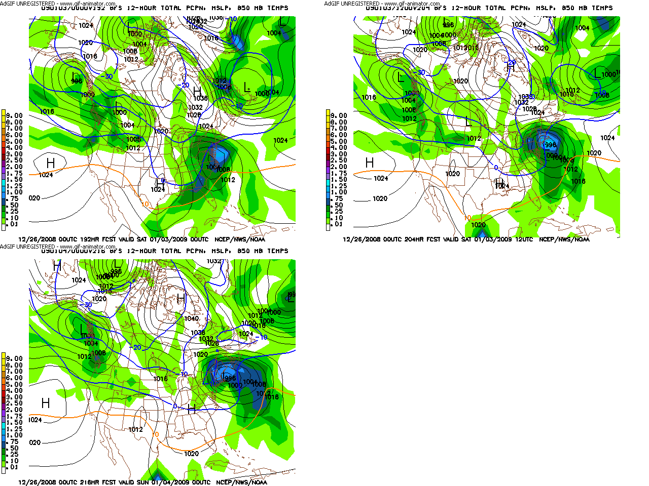
 The 00z 12/26 GFS shows a storm more in tune with the hybrid type I mentioned, and the latest HPC long range D7 map as a blend of the Euro and GFS displays this as well. In addition, with the development of a more west based -NAO, the strong blocking is shown to hold this storm in place near New England for possibly a 24 hour stretch. This is something we have not seen for a long time. We have gotten intense snow storms, and periods of -NAO blocking but its usually too far east, and what results is the 10 to 12 hour bursts of snow (that were a theme of last year). We have not had a classic slow mover in many years. QPF totals of 2" to 2.5" inches over the region is displayed on the 00z GFS.

As much as the ultimate track of the storm is always an issue, it will likely not be as significant of a forecast problem for the long range. This is because of the blocking in place, limiting any notable deviation from an east coast track. If anything, the storm may be suppressed to the southeast too much, but a Great Lakes track is unlikely given the concurrent pattern.
Here is an excerpt from the HPC preliminary long range discussion:
ZONAL FLOW WILL KEEP GENERALLY MILD CONDS THRU MID WEEK UNTIL
COOLER AIR PUSHES EWD WED/THURS. OP MODELS GFS AND ECMWF ARE IN
PRETTY GOOD AGREEMENT ON THE DIGGING SHORTWAVE DRIVING INTO THE MS
VALLEY AND TAKING A NEG TILT LATE FRIDAY INTO SAT. CMC DIGGING ITS
TROF WWD OF GFS/ECMWF AND IN CLOSER AGREEMENT OF LOCATION TO GFS
ENS RUNS RESULTING IN DEEP SRLY FLOW ACROSS ERN CONUS FRIDAY.
PREFERENCE AT THIS TIME IS GFS SERIES AND ECMWF WHICH BOTH CONT TO
INDICATE A PRIMARY OH VALLEY LOW WHICH WILL SHIFT ITS ENERGY TO A
SECONDARY LOW FORMING OFF THE SERN SEABOARD..MILLER TYPE B
CYCLOGENESIS. THIS LOW WILL BEGIN TO DEEPEN OFF THE VA CAPES AND
MOVE NEWD OFF THE NORTHEAST AND NEW ENG COASTS SAT. PCPN TYPE
DETAILS ARE VERY UNCERTAIN AT THIS TIME FRAME ALONG THE COASTAL
PLAIN OF BOTH THE MID ATLC AND NORTHEAST COASTS WITH MODEL RUNS OF
BOTH GFS AND ECMWF HAVING ENOUGH MID LEVEL/TRACK AND THERMAL
DIFFERENCES WITH NEITHER DEEP ARCTIC NOR VERY WARM AIR IN PLACE
OVER THE REGION AHEAD OF THIS SYSTEM TO GIVE A YIELD IN EITHER
DIRECTION. THIS WILL NEED TO BE CLOSELY MONITORED OVER THE NEXT
WEEK AS SOME PARAMETERS ARE MET FOR A SIG WINTER STORM ESPECIALLY
OVER THE NORTHEAST.
No comments:
Post a Comment